
OUR ELECTORATE
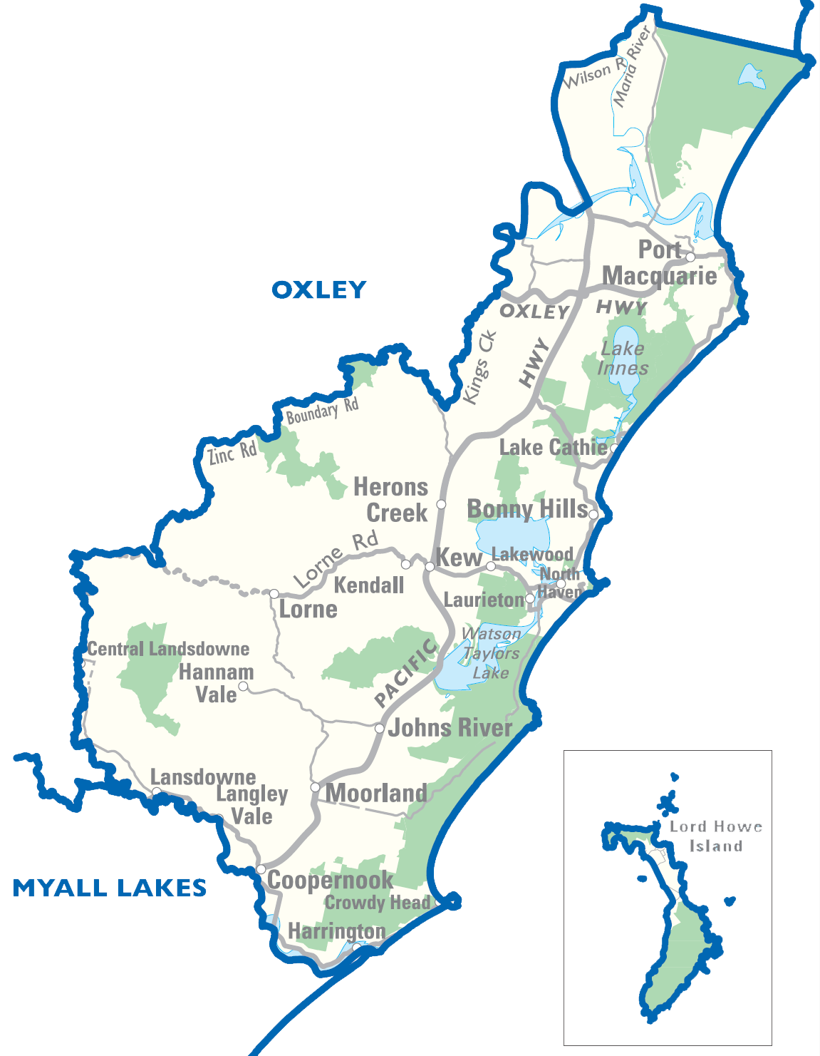
From Limeburners Creek Nature Reserve in the north to Harrington in the south; and from Hannah Vale in the west to the New South Wales coast in the east (inclusive of Lord Howe Island and all islands lying off the coast of the district).
Rural. Located within Hastings Statistical Agricultural Subdivision.
Principal towns: Batar Creek, Black Creek, Bobs Creek, Bonny Hills, Camden Head, Comboyne, Coopernook, Coralville, Crowdy Bay National Park, Crowdy Head, Deauville, Diamond Head, Dicks Hill, Dunbogan, Fernbank Creek, Grants Beach, Hannam Vale, Harrington, Herons Creek, Johns River, Jolly Nose, Kendall, Kew, Lake Cathie, Lake Innes, Lakewood, Langley Vale, Laurieton, Limeburners Creek, Logans Crossing, Lord Howe Island, Lorne, Middle Brother, Moorland, North Brother, North Haven, North Shore, Port Macquarie, Rossglen, Sancrox, Stewarts River, Swans Crossing, Thrumster, Upsalls Creek, Waitui, West Haven.
Area: 1,345 sq km.
Enrolments to vote: 61,609.
Geographic Information
Area: 1345 square kilometres
Postcodes:
2426, 2427, 2429, 2430, 2439, 2441, 2443, 2444, 2445, 2446, 2898
Local Government Areas within district:
Parts of Greater Taree and Port Macquarie - Hastings.
Localities:
Batar, Bonny Hills, Coopernook, Coral Ville, Crowdy Head, Dunbogan, Hannam Vale, Harrington, Herons Creek, Hibbard, Johns River, Kendall, Kew, Lake Cathie, Lakewood, Lansdowne, Laurieton, Langley Vale, Limeburners Flat, Logans Crossing, Long Point, Lord Howe Island, Lorne, Moorland, North Haven, North Shore, Port Macquarie, Rossglen, Sancrox, Stewarts River, Swans Crossing, Thrumster, Waitui.
This list is indicative only.
Demographic rating
Rural.